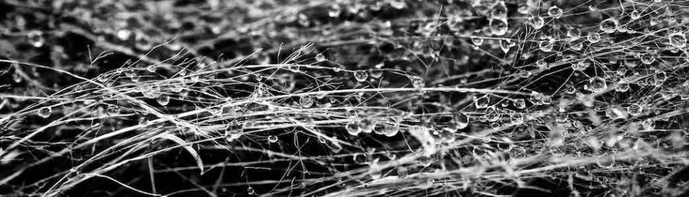
Here is a link to the latest walk I have published on VictoriaWalks walkingmaps https://walkingmaps.com.au/walk/5483
Port Campbell Discovery Walk
1
Here is a link to the latest walk I have published on VictoriaWalks walkingmaps https://walkingmaps.com.au/walk/5483
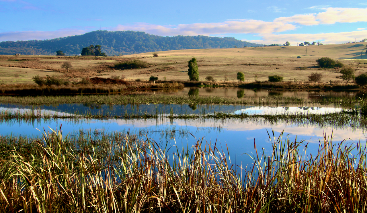
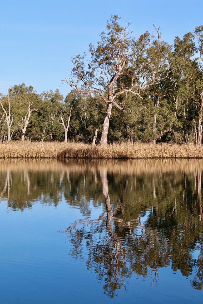
Link & Chain / Road Cycling Route

Route Name / Address:
Nagambie – Murchison Loop
Start / Finish locations:
Nagambie Railway Station Prentice St., Nagambie 3608
Mode:
Road bike (or any other mode you prefer)
GPS 36.785292° S 145.160579° E
Difficulty:
Easy – as long as the distance is OK for you
Distance:
50km
Elevation:
211 – 145m
Topography:
Flat
Surfaces:
Sealed bitumen. Narrow around Kirwans Bridge and Goulburn Weir. Firm dirt shoulders. Murchison East has quite a bit of through traffic, but broad sealed shoulders. Morningside Rd has quite a bit of patching. It is the roughest section, not too bad.
If you wish to join the Rail Trail to Rushworth at Murchison (another 7 – 10km one way dependent on where you start), you will require a bike able to manage a gravel surface.
Description and Features:
Nagambie is well serviced, Murchison less so, but can offer accommodation, food and drink. This is flat river plains country. The route parallels the Goulburn River, Weir and major irrigation canals most of the way. There are various scenic sites, such as the aged Kirwans Bridge, broad vistas across prime grazing and cropping land, quality horse studs and wineries.
Riding conditions:
Generally, fairly low traffic during the week with more tourists about on the weekends. Some long straight stretches. There is little shelter from the elements on the road.
Options:
Include the Rail Trail to Rushworth.
Start anywhere
Clockwise or anti
Clockwise Cues:
Start Nagambie Railway Station
Straight Prentice St
Right High St
Left Lobbs Lane
Left Kirwans Bridge Rd
Right Goulburn Weir – Murchison Rd
Right High Rd
Right Wahring – Murchison Rd
Left Morningside Rd
Straight Hayshed Rd
Straight Grimwade Rd
Straight High St
Left Prentice St
Straight Nagambie Railway Station
Amenities (in each township):
Car parking
BBQ
Fuel
Shops
Winery
Seating
Parkland
Waterway
Playground
Picnic tables
Public toilets
Potable water
Walking tracks
Accommodation
Historic features
Sports Reserves
Swimming Pool
Railway stations
Directional signs
Information signs
Extension routes
Cautions:
Open water
Soft shoulders
Limbs may fall
Embankments
Uneven ground
Slippery surfaces
Subject to flooding
Road surfaces vary
Snakes may be active
Beware of vehicle traffic
Mobile reception may be unreliable
No potable water outside townships
Carry food, water, First Aid, be SunSmart
Be equipped for self-reliant riding
Restrictions:
Take rubbish with you
Historic relics are protected
Native flora and fauna are protected
Riders must use formed roads only
This morning’s interview with presenter Matt Dowling regarding my work on tracks and trails promotion in the Strathbogie region. Commences at 43.30minutes.


Click on this link for access to my photos in the report Strathbogie Shire Council Annual Report 2020
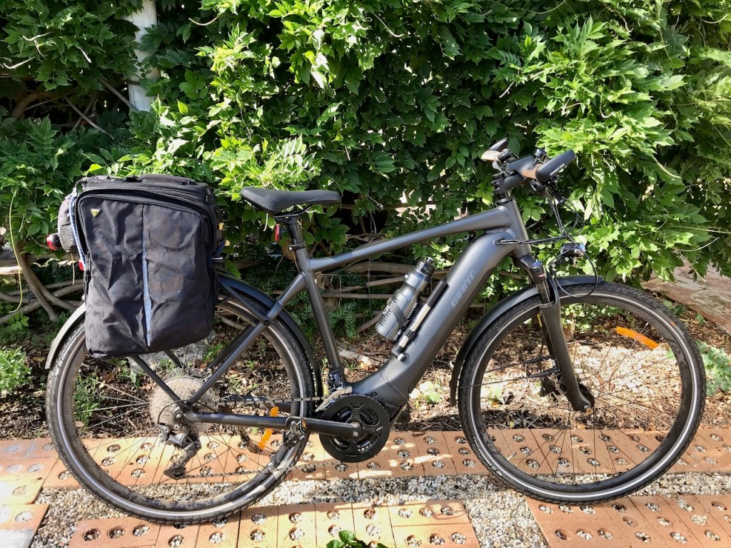
Sub title: Central Victoria, the Centre for eBikes.
As I have aged (now approaching my mid 60s), I have progressed from road bikes to mountain bikes to hybrids and now, ebikes.
My message to everyone out there who rides or is contemplating riding is “Get on your bike!” If you are fit and able enough to provide your own power, find the bike that best suits your journeying and ride. If you think you are past it, reconsider. From 8 to 80 years old, anyone with balance who can get astride a bike frame now has bicycle touring at their feet!
With the advent of ebikes for all modes of cycling, the Central Victoria region is perfect for you and your bike. There are many kilometres of un-trafficked rural roads and tracks traversing diversely beautiful landscapes. You will be amazed at where an ebike can take you, from sealed flat stretches across the plains, amongst rustic rolling foothills, to tall treed dirt tracks through mountain forests.
Many people have asked me about the different modes of cycling I refer to in the cycling route descriptors I publish. Most often, about Gravel Grinders. Gravel Grinders as a specialty appeared somewhere in amongst my cycling experience. I missed their rise until alerted by a mad keen cycling cousin.
This alert coincided with the commencement of my mapping and publishing of walks and cycling routes in and around the beautiful Strathbogie region. A good port of call for those interested is the Gravel Grinders Melbourne fb page. The article linked below may be American, but is brief and indicative of gravel bike features for the uninitiated, as well as being fodder for dreamers. It is worth noting that one of the bikes listed is an ebike.
apple.news/AJlzTcm5gRhO2EROnKg-VTw
The cycling routes I have been recording will be found here on seanmathews.blog/cycling and the Connecting the Goulburn Broken Catchment Facebook Group https://www.facebook.com/groups/591666734808645 .
Walks can be found at strathbogierangesnatureview , VictoriaWalks and in Pozi online mapping
Advertising seduces me into ever wanting more. Advertising leaves me wanting.
Nature arouses in me the need to belong, experience and explore. Nature fulfils these needs and more.

Natural world spaces beckon. A track, a trail, a waterway, a forest, a desert, a garden, a valley, a mountain, a park. They call on us to linger in place, to appreciate and contemplate. They feed our souls and refresh our minds. They represent and deliver the simplest pleasures of life, observing and feeling part of the interconnectivity of everything.
I recently read David Attenborough’s 2020 book, “A life on our planet: My witness statement and a vision for the future”. Ever since, I have been contemplating how on earth it will be possible to action the plans he outlines for preserving functional global climate systems, biodiversity, and saving ourselves from ourselves.
Rewilding is one solution Attenborough envisages. A small example may be when many urban neighbourhoods develop their own small forests and foster biolinks. The cumulative effect could be significant. Just as each relatively small piece of new built environment and mono cultural agribusiness diminishes our capacity to recover, each relatively small piece of new ecosytem and forest enhances it. See www.bbc.co.uk/news/stories-56003562
As I head
toward the door
Questions
head my way
Where are you going?
Walking.
Where to?
It doesn’t matter, I say
Walking
a destination in its own right
Walking
the easiest way
we can fully engage
With the natural world
In walking
we place ourselves
at a new destination every minute
we escape ourselves
And we expose ourselves
to genuine experiences
of our surroundings
and the elements
on the human scale
What will you look for?
I smile
knowing whatever I look for
I will also find many things different
I don’t need to look
for anything in particular
because I will find
small parts of everything
Walking always takes me there
Today, I wrote, edited and proof read in preparation for publication of many more tracks and trails. I did it for myself because of all the wonderful experiences I have when bushwalking. I did it for the community because I believe the natural world is one of the best places to restore yourself and others. I did it for habitat improvement, to help everyone learn the conservation values important for saving our future.
I am trying to learn the names of the local wildflowers as I walk. I was surprised to find so many on Hughes Creek Hill in mid winter. The file names are what I think these are. Corrections welcome. There is also one unknown I need assistance with.


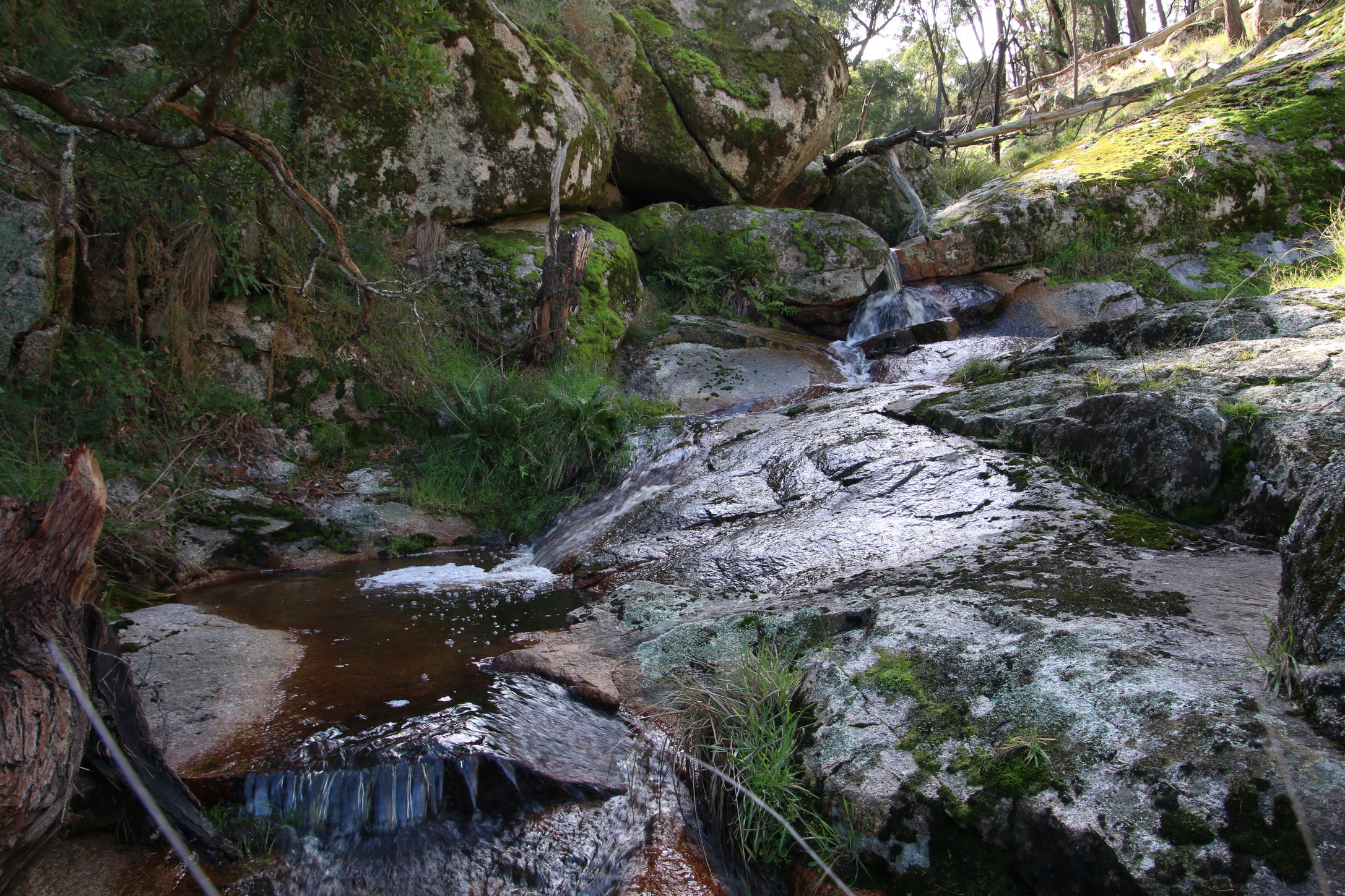
Wallaby Gully, Upton Hill has the cutest little stream.
Trail Checklist
Name:

Responsible Authorities:
Acceptable modes of transit:
Distance & duration
GPS coordinates & map
36°47’07.8″S 145°09’11.0″E
-36.785508, 145.153068
 Grading (using the Parks Vic Track and Trail Grading Manual):
Grade 2
Amenities:
Hazards
Snakes, slippery surfaces, embankments, falling trees and limbs, deep water
Restrictions
Trailhead sign
Informational Signs
Directional signs / bollards or trail markers
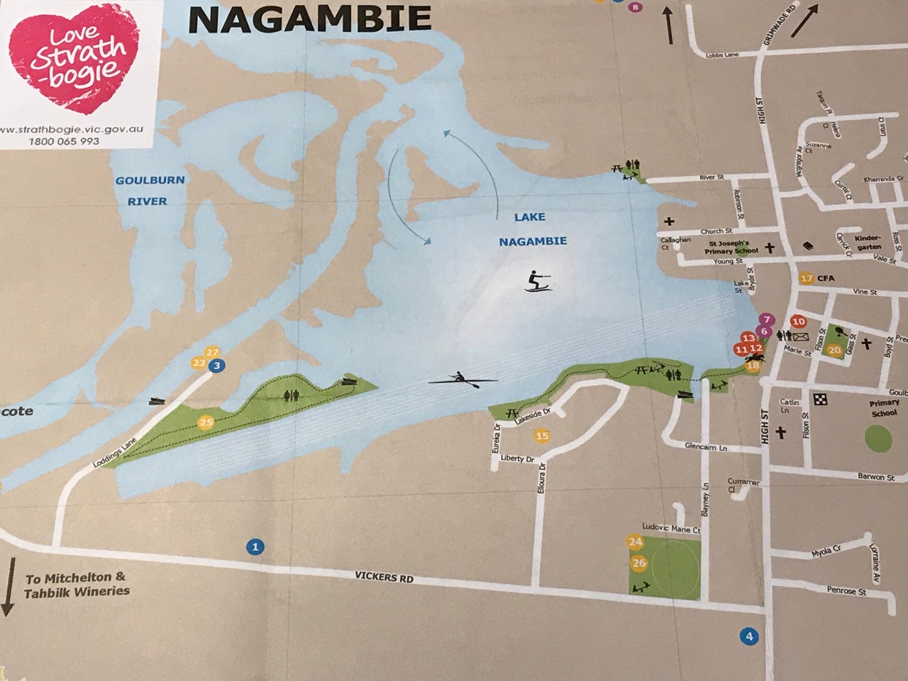
Conclusion
This pleasant walk is in current use and offers many amenities to visitors. A feature map brochure, separate to the Nagambie Tourist Map and including the Regatta Centre Walk, would encourage more people to extend their visit beyond just looking over the Lake from High Street.
Trail Checklist
Name:
Honeysuckle Creek Walk, Violet Town

Responsible Authority:
Authorities
Community
Acceptable modes of transit:
Distance & duration
GPS coordinates & map
36°38’01.0″S 145°43’05.8″E
-36.633606, 145.718286

Grading (using the Parks Vic Track and Trail Grading Manual):
Amenities:
Hazards
Snakes, tree and limb falls, flowing water, uneven ground and slippery surfaces
Restrictions
Trailhead sign
Directional signs / bollards or trail markers
Conclusion
This is an established, easy, bushy parkland walk with options for longer or shorter loops available. It is currently in frequent use by the public.
Trail Checklist
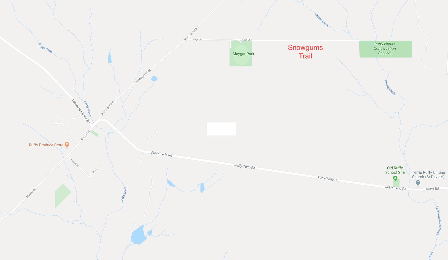
 Extends from Noyes Lane, Ruffy.
This track meanders down an unused road reserve through open Narrow-leaf Peppermint forest until it crosses a walking bridge and enters the Ruffy Flora Reserve. A circuit of this reserve takes you through swampy riparian woodlands dominated by ancient Mountain Swamp Gums. The path continues past a tiny population of Snow Gums, remnants of a colder climate, and skirts a chain of dark deep billabongs into bandicoot and koala territory.
Responsible Authority:
Road Reserve: Strathbogie Shire Council
Ruffy Nature Conservation Reserve: DELWP
Acceptable modes of transit:
Walk (mountain bike and horse with track improvement)
Distance & duration
3km return, 1.5hrs to the Reserve.
Additional loops could be added:
GPS coordinates & map
36°58′4″ S 145°30′56″ E
-36.967745, 145.514873
Grading (using the Parks Vic Track and Trail Grading Manual):
Grade 3. Flat, but with some uneven ground and open woodland debris underfoot. Could be rated easy with trail clearance.
Amenities:
The walk commences at the Ruffy Recreation Ground, Maygar Park.
Parking at the Ruffy Recreation Ground
Shelter and picnic facilities at the Recreation Ground
Toilets at the Ruffy Recreation Ground
Horse containment at the Recreation Ground
Hazards
Tree & branch falls, uneven surfaces, bogs, flowing water, snakes
Restrictions
Take your rubbish with you
No potable water
Trailhead sign & Informational Signs
No trailhead sign in situ (there is one in poor condition that has been removed).
Directional signs / bollards or trail markers
No directional signs on nearby roads
No trail markers along the trail, but some exist within the Reserve
Brochure
Available
Conclusion
This trail has the potential to be a key feature for visitors to Ruffy. With some basic work, it could be improved considerably. This trail is currently accessible to walkers and is in occasional use. However, until the trail has been cleared for snake sighting, recommended use is probably best confined to the cooler months. With improvement, it would be a viable all year walking, mountain bike and horse trail.
