In Forests #02
Image
1
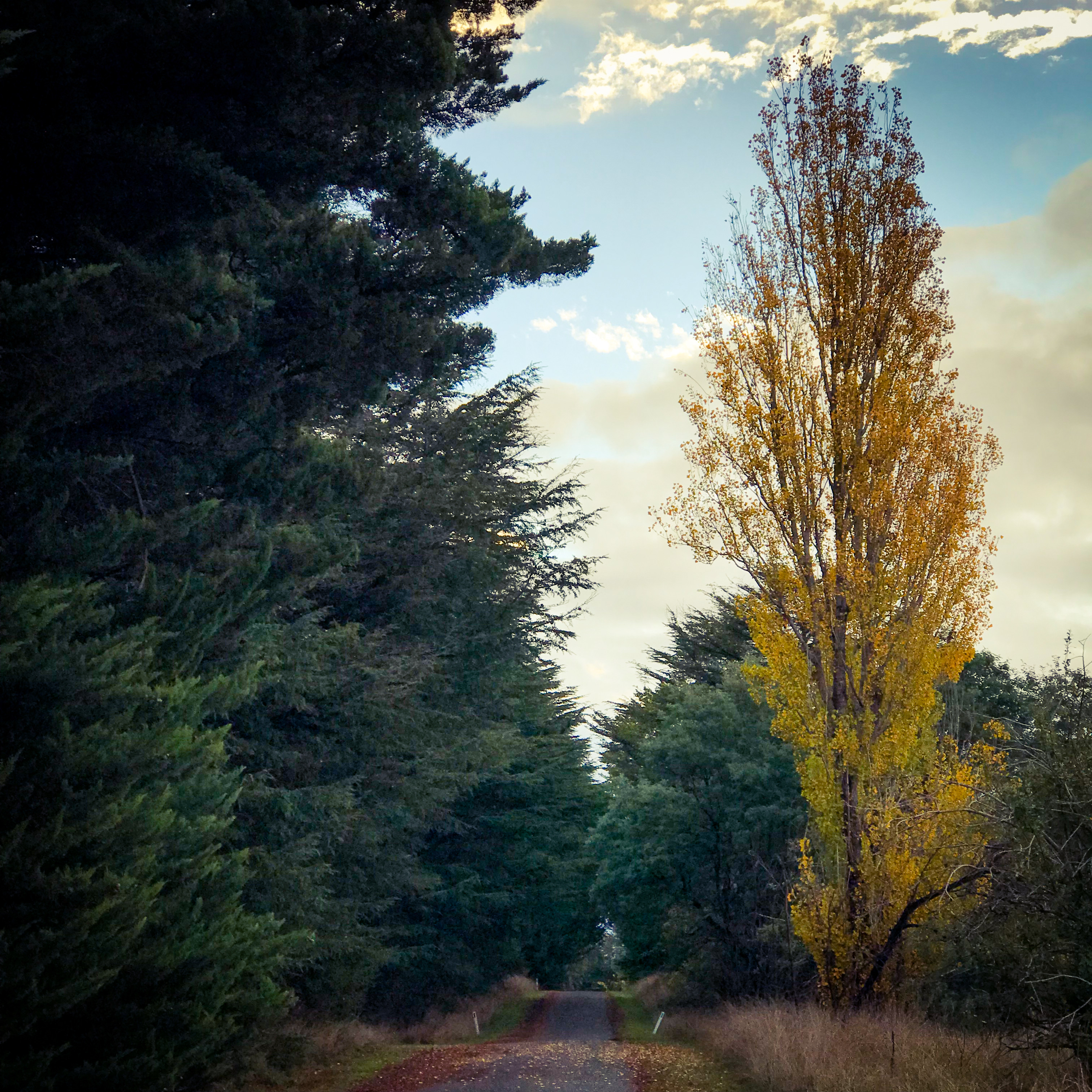
Walking the Strathbogie Ranges has many rewards. The landscapes, waterways and native flora are simply beautiful.
A gallery of 10 images. To see the full photos click an image, then use the arrows to scroll.


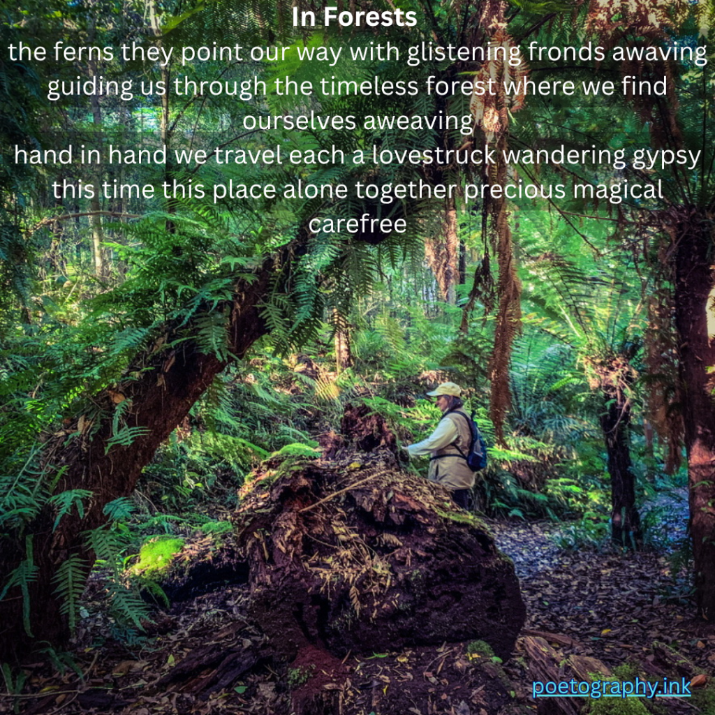
I'm walking in the evening
smelling all the sounds
I'm strolling through the gloaming
Doing my enchantment rounds
I'm catching all the moonbeams
and putting them in my pocket
Remembering fondly daydreams
Preparing days last docket

The path is lit so brightly
in silver and dappled grey
The water sprites dance lightly
on moonlit water spray

And where the cascading creek
pools calmly at my feet
it reflects the Milky Way

I'm walking in the evening
Hearing all that I can see
I sense the bobuck in the tree
before the bobuck senses me
A tawny frogmouth silhouettes
against a star bright sky
With silent flight of no regret
his dive is only heard by eye
White shades of cockatoos
perch ghostly in pairs aloft
Crests rising to the "Who? Who?"
of the barn owl in near croft
A mother koala briefly joins me
on her own purposeful  path
Her joey clinging grimly
to her shoulders makes me laugh

And then a cool spring breeze
tousles my hair as if to please
and praise my meandering task

I'm walking in the evening
touching scents borne on air
I'm feeling all I'm feeling
I'm shedding care by care

Honeysuckle's sweet subtle breath
permeates  all around
Bullrushes whisper secrets kept
Chocolate lilies abound

The swamp gum rustles above me
The peppermint towers high
The snow gum looks so lovely
as I tread quietly by
Flowering gums are tipped with fairy tutus
The manna creaks as it sways
All sprinkle the night with eucalyptus scent
whispering to the wind, “Australian bush” they say

And then on the horizon I see my home
It calls me from my roaming
To sit in darkness without a sound
I savour all the night has shown me
while walking in the evening
This week the d’verse prompt is from Lillian. She asks we poets to, “Take a walk with me.” You can view the full prompt here https://dversepoets.com/2023/09/05/take-a-walk-with-me/ I have chosen to rework a poem from a while ago that reflects on walks in the evening near my home. I hope you enjoyed walking with me.


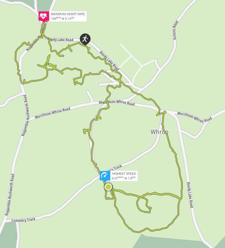
Map
GPS coordinates -36.646502 145.026763
| Distance |
| 7km |
| Difficulty |
| Grade 3 |
| Duration |
| 3-4 hours (bushwalking) |
| Alternative Recreational Uses |
| Birdwatching, mountain biking, photographing, picnicking, orienteering and driving (on formed roads only). Prospecting and fossicking require a Miner’s Right.
Motor bikes / 4WDs must be registered, riders / drivers licensed & stay on formed roads. |
| Seasonal Information |
| Wildflowers in spring and autumn. Muddy tracks in winter. Very hot and dry in summer. |
| Cautions |
| The Information Centre is permanently closed.
Signs and trail markers may be damaged Unauthorised and poorly defined tracks and trails exist. Take care not to get lost! No potable water is available. No pets. Take your rubbish with you. Grass trees are vulnerable to cinnamon fungus transfer: keep to formed roads and tracks. |
| Amenities |
| Car parking, public toilets, picnic tables, fire grates, interpretive signs, trail markers and camping |
| Management and Support Groups |
| Parks Vic |
Location
To access the Whroo Historic Area, drive through the Rushworth State Forest via the Rushworth – Nagambie Rd. 7km south of Rushworth Township, turn left into Reedy Creek Rd. The central car park with public toilets is 0.5km from this intersection on the right.
Track Notes
This is often a quiet, empty place of bushland, native flora and fauna. Exploration of the Whroo Historic Trail unearths evidence of a different, busy, crowded and culturally significant past. The open cut of the impressive Balaclava Mine marks one end of the journey. Remnants of Victoria’s gold rush era can be discovered all along the way. Underground storage tanks, mining shafts and tunnels, building rubble and foundations, century old rubbish dumps and gold mining infrastructure comprise an historic treasure trove. Once spring fed Aboriginal rock wells close these historic trail loops.
You can enter the trail loops at any point. However, the sizable central car park with picnic and toilet facilities is probably the most convenient place to start and finish.
Head uphill to the right of the public toilets to join the Balaclava Mine section of the trail. The trail is well-defined, being constructed of a crushed quartz and gravel surface. Be wary, the gravel can slip. There are 2 viewing points into the open cut. Watch out for locked gated tunnels through the hill. The larger was for a tramline. Access into the open cut is now prohibited due to the high risk of rock falls.
After you pass the second viewing point, cross nearby Rushworth – Nagambie Rd to see the original battery dam. If you are lucky, you may see tortoise on the bank. Fish live in this water.
There is great mountain biking below the dam wall. Procced downhill parallel to the road while looking across the road to your left. Cross the road to the first trail on your left to rejoin the Balaclava Mine loop. You will return to the central car park via mullock heaps and the site of the Lewis homestead.
Once back at the central car park, this time head downhill, towards Whroo Cemetery. Keep to the left of the open grassy space you initially traverse. Imagine it humming with the sounds of a 10,000 strong population. Take care, like this space, some walking trails may not be well defined due to variable local conditions. You will arrive at a dirt road. Head along the road to your right to resume the trail on the opposite side, beside Poor Man’s Gully. Observe the mullock heaps of gold mining detritus as you pass by.
You will come to Cemetery Road. Cross here to follow the cemetery driveway into the cemetery itself. There are 400 graves here, many unmarked. Take time to reflect on the timing and causes of death in gold rush Whroo.
The next stop will be the Aboriginal waterholes. Follow the trail behind the cemetery around the base of the nearby low hill to the left of the cemetery. Passing through stands of grass trees, you will come to an intersection. Follow the trail marker on your left pointing up the hill. Cross the next dirt road to the ramp that leads to the waterholes.
Return back down the same trail section to the intersection and turn left to resume the trail. This will now run parallel with Reedy Lake Rd until it reaches Cemetery Rd. Cross to the picnic tables on the corner. To return to the central car park, continue uphill parallel to Reedy Lake Rd. You have completed your trail loops.
Options
Topography and Geology
Of the undulating rises to low hills, Balaclava Hill is the highest point in the Whroo district. It was a very rich mine. During the Silurian period, an intensely heated earth’s crust beneath the gold fields pushed volcanic rocks into extremely-hot salty water. As the water moved closer to the surface and cooled, gold crystallised out with quartz. 600 million years later, this resulted in a 19th century fortune of more than £1,000,000 from quartz bearing gold veins of up to 15cm across. Whroo goldfields are estimated to have produced 40,000 ounces of gold.
Flora
Whroo Historic Area comprises 490 hectares within the world’s largest ironbark forest of 24,300 hectares. The forest itself harbours a canopy of red and mugga ironbark, grey box, yellow box, white box and red stringy bark. The mid story contains grass trees, blackwood, golden wattle, spreading wattle, casuarina, melaleuca and dogwood. There are occasional patches of mallee. The understory consists of grevillia, drooping cassinia and bush pea. A ground layer of native grasses, woodland flowers including orchids and bulbous plants completes a unique native bush landscape.
Fauna
Kangaroos, wallabies, yellow footed antechinus, brush tailed phascogale, squirrel glider, common dunnart, legless lizards, tree goannas and tortoise may be spotted. Particularly, if you choose to camp overnight.
Birdlife
Rushworth State Forest is listed as an eBird Australia hotspot with records of 150 species, including the powerful owl and threatened swift parrot.
Local History
The Nguraililam-wurrung aboriginal people used ironbark forest timber to fashion canoes, hunting implements and construct shelters. Ironbark blossom made a sweet beverage. The name “Whroo” is said to come for the word meaning lips. This was a reference to the aboriginal watering holes in the area.
Gold was discovered in Rushworth in 1853. In 1854, a gold nugget was discovered in grass at Balaclava Hill by John Lewis and James Nickinson. The consequent goldrush lasted much of the decade, recurrently bringing thousands to try their luck. Gold mining began with alluvial diggings, proceeding to open cut methods as alluvial returns diminished. By 1860, a population of just 450 remained. The Balaclava Hill Mine continued to be productive until it was shut down in the 1870s due to water management problems. However, shafts have been mined since. The last active shaft was filled by the Mines Department in the 1960s.
In its time, the Whroo township accommodated a Mechanic’s Institute, a state school, a post office, a savings bank, a free library, 2 churches, 3 ore crushing mills, 3 hotels and a cordial factory. 139 buildings were still present in 1871.
Rumour has it Ned Kelly and his gang visited the area. Prior to anticipated trouble with the local constabulary, it is said a cache of Kelly gold was stashed in the area and never found again …..
Whroo cemetery reflects the undiscriminating difficulties of life in a harsh environment, where neither age, nationality, culture nor religion provided protection. Chinese miners make up 15% of those buried. They were a significant part of the community as miners, for operating puddling machines and growing market gardens.
However, by the 1920s ironbark timber cutting was the principal remaining industry. By 1933 the population had fallen to just 52. By 1955, Whroo was a ghost town.
In case of emergency
Call 000
